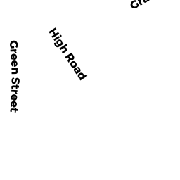
28 HIGH RD
Owner Information
BENNETT TTEE FARIS E.
28 HIGH RD
NEWBURY, MA 01951


Property Details
28 HIGH RD is classified as a Single Family Residential (Colonial).
The primary structure on this property was built in 1875. There are 2,286ft2 of built area within this property. There is 2,286ft2 of residential/living space within this property. This property is listed as having 8 rooms.
28 HIGH RD is valued at $950,200. The land is valued at $244,900 and the structures are valued at $692,500. There is an additional valuation of $12,800 on this property.
The most recent deed for 28 HIGH RD is recorded at the local registrar in Book 38383, Page 472. 28 HIGH RD was last sold on Monday, March 16, 2020 for $999,000.
Assessment data from fiscal year 2022.
Flood Data
According to the FEMA National Flood Hazard Layer, this property does not appear to be in a flood zone. It may also be in an area not yet reviewed. Nonetheless, confirm this information prior to taking any action.
To view the flood hazards around this property, create a FEMA "Firmette" Map of the area around 28 HIGH RD.
Broadband Internet Providers
| Provider | Type | Bandwidth (mbps) | |
|---|---|---|---|
| GCI Communication Corp. | Satellite | 0 | 0 |
| Viasat Inc | Satellite | 100 | 3 |
| HughesNet | Satellite | 25 | 3 |
| VSAT Systems, LLC. | Satellite | 2 | 1 |
| Comcast | Cable | 1000 | 35 |
| Verizon New England Inc. | DSL | 15 | 1 |
| T-Mobile | Fixed Wireless | 25 | 3 |
Broadband service provider data from December 2020.
Adjacent Properties
- 10 PARKER ST
Single Family Residential owned by HARRIS RICHARD C - 8 PARKER ST
Single Family Residential owned by BURKE SHANNON COLBY - 6 PARKER ST
Two-Family Residential owned by SELKIRK GAYLEE S - 26 HIGH RD
Single Family Residential owned by ALBRECHT PETER L - 2 PARKER ST
Single Family Residential owned by ORPIN WILLIAM - 32 HIGH RD
Other, Non-Taxable Condominium Common Land owned by HIGH RD - 30 HIGH RD
Other, Non-Taxable Condominium Common Land owned by HIGH RD - 32 HIGH RD
Residential Condominium owned by MCCARTHY CHRISTOPHER J - 30 HIGH RD
Residential Condominium owned by ARMSTRONG BENJAMIN C